Active Travel Network Plan map
Prioritised active travel routes
Strategic corridors follow the strategic corridors set out in the Cumbria Transport Infrastructure Plan (PDF). The Cumbria Transport Infrastructure Plan was produced by the former Cumbria County Council in 2022 and is used by Cumberland Council and Westmorland and Furness Council until such time as they receive guidance to produce new Local Transport Plans.
Heart of the Lakes
Route: Keswick to Threlkeld Extension, Grasmere to Dunmail Raise, Thirlmere West Shore quiet road and crossing
- Ambition: Complete design, planning permission (Keswick to Threlkeld only) and tendering, submit full business case to Borderlands Project Management Office to draw down allocated funds, deliver projects by March 2027.
- Timescale: Within 5 years, funded or part funded
- Category: Strategic Corridor
- Partners: LDNPA, W&F Council, Cumberland Council
Route: Round Thirlmere route, East
- Ambition: Install underpass on A591, create new sections of trail with reduced gradient, waymark forest trails.
- Timescale: Within 8 years, subject to funding and landowner permissions
- Category: Strategic Corridor
- Partners: United Utilities, Cumberland Council
Route: Kendal to Plumgarths
- Ambition: Segregated cycle path.
- Timescale: 8 years + subject to funding and landowner permissions
- Category: Strategic Corridor
- Partners: W&F Council
Route: Brockhole to Ambleside
- Ambition: Cycle route avoiding A591. More feasibility required.
- Timescale: 8 years + subject to funding and landowner permissions
- Category: Strategic Corridor
- Partners: LDNPA and W&F Council
North Lakes
Route: Bassenthwaite Cycleway
- Ambition: Complete traffic free and quiet lanes route around Bassenthwaite.
- Timescale: Within 8 years, subject to funding and landowner permissions
- Category: Strategic Corridor
- Partners: National Highways
Route: Keswick Railway Extension towards Penrith
- Ambition: Exact route to be determined. Upgrading of footpaths and bridleways connecting Keswick to Threlkeld extension to Troutbeck.
- Timescale: 8 Years + subject to funding and landowner permissions
- Category: Strategic Corridor
- Partners: LDNPA/W&F Council
Hadrian’s Wall and West Coast
Route: Gosforth to Calderbridge (missing link in NCN72)
- Timescale: Within 5 years, funded or part funded
- Ambition: Develop off road cycle route avoiding A595.
- Category: Strategic Corridor
- Partners: Cumberland Council, Sustrans, Local Community
Route: Esk to Barrow
- Ambition: Multi-user trail linking along SW coast of Lake District, including bridges over Esk, Irt and Duddon.
- Timescales: Within 8 years, subject to funding and landowner permissions
- Category: Strategic Corridor and link into the LDNP
- Partners: Community group, Cumberland Council, W&F Council
Eden and Lune Valley
Route: Yorkshire Dales Connections
- Ambition: Working with the Yorkshire Dales National Park Authority to create quiet lane routes connecting Kendal, Sedbergh, Shap, Haweswater, Orton, Tebay and Penrith where National Cycle Network links are not present.
- Timescales: Within 5 years, subject to funding and landowner permissions
- Category: Strategic Corridor and link into the LDNP
- Partners: LDNPA, YDNPA, W&F Council
Additional strategic corridors
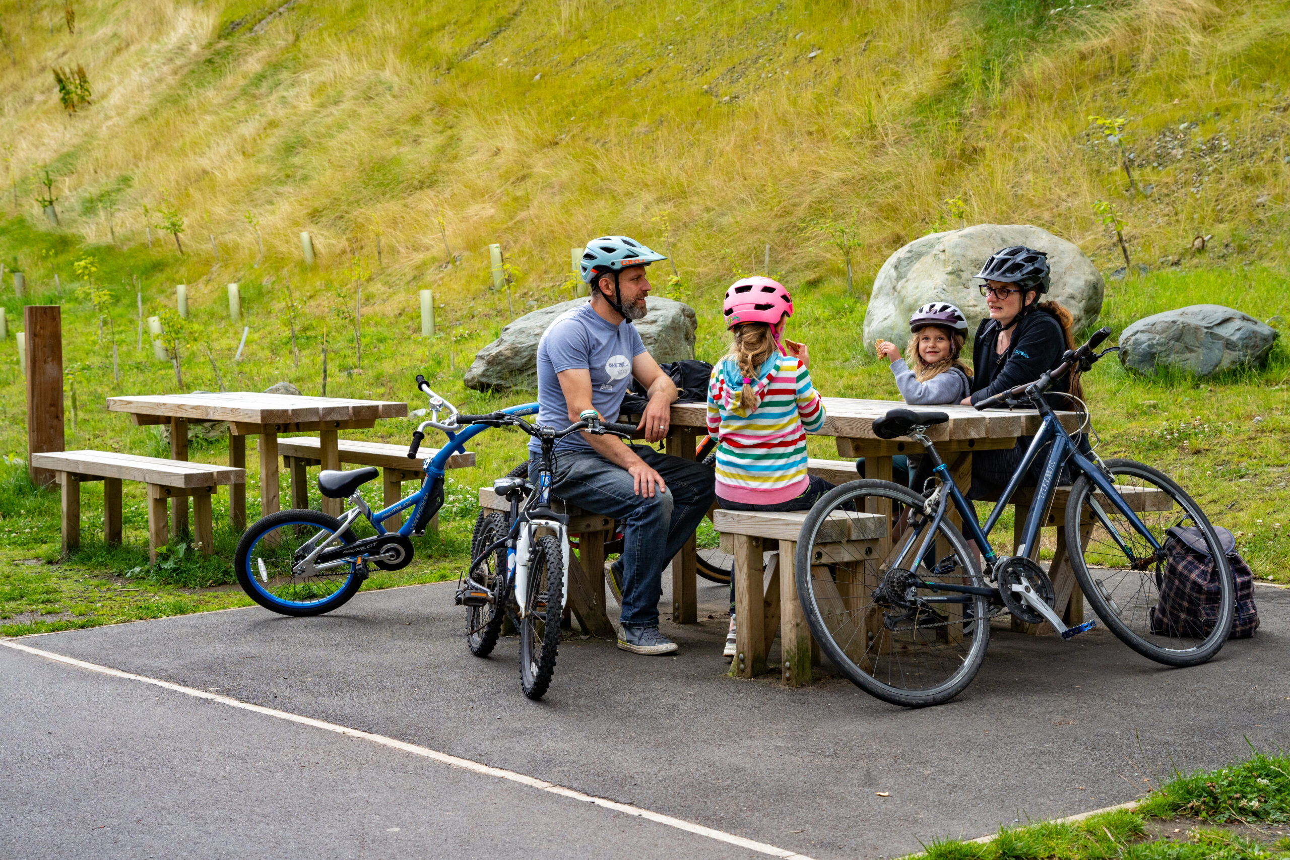
Additional active travel strategic corridors outlined in the Network Plan build upon and enhance strategic corridors detailed in the Cumbria Transport Infrastructure Plan. These additional corridors are designed to improve connectivity between key settlements within and into the Lake District National Park. By targeting key settlements, the corridors aim to support everyday journeys for local residents and leisure trips for tourists. The corridors are ambitious, long-distance routes that seek to promote walking, cycling and wheeling as alternatives to car travel.
Secondary links offer additional connectivity enabling communities and visitors to access local amenities, schools and public transport.
Route: Derwentwater accessible trail
- Ambition: Design and deliver 7km long accessible route from Great Wood and Crow Park.
- Timescale: Within 5 years, funded or part funded
- Category: Secondary Link
- Partners: National Trust
Route: Bootle – Wellbank – Bootle station
- Ambition: Design and deliver active travel link, connecting to public transport.
- Timescale: Within 5 years, funded or part funded
- Category: Secondary Link
- Partners: Bootle Parish Council, Cumberland Council
Route: Walking Trails
- Ambition: Work with partners to deliver the Coast to Coast Walk National Trail, the Westmorland and Furness Way and the Penrith to Kendal trail.
- Timescale: Within 5 years, funded or part funded
- Category: Secondary Link
- Partners: Natural England, W&F Council, Cumbria Connects
Route: Ullswater Way
- Ambition: Consider options to improve safety and user experience of the Stybarrow Crag part of the Ullswater Way north of Glenridding.
- Timescale: Within 5 years, funded or part funded
- Category: Secondary Link
- Partners: Friends of Ullswater Way
Route: West Windermere Way
- Ambition: Complete missing section between YMCA Lakeside and Ferry House and extend from Newby Bridge to Haverthwaite and Newby Bridge to Fell Foot.
- Timescale: Within 5 years, subject to funding and landowner permissions
- Category: Secondary Link
- Partners: LDNPA
Route: Valley Travel Plans
- Ambition: Deliver key outputs and recommendations from the valley plans being developed for Langdale, Ullswater, Hawkshead, Wasdale
- Timescale: Within 8 years, subject to funding and landowner permissions
- Category: Secondary Link
- Partners: LDNPA and W&F Council
Route: Ferry House to Hawkshead
- Ambition: Improve cycle infrastructure through quiet lanes and off-road sections of path.
- Timescale: Within 8 years, subject to funding and landowner permissions
- Category: Secondary Link
- Partners: LDNPA
Route: Wasdale traffic management
- Ambition: Implementation of traffic management plan developed through ATE capability funding.
- Timescale: Within 8 years, subject to funding and landowner permissions
- Category: Secondary Link
- Partners: Cumberland Council
Route: Haweswater
- Ambition: Eastern side bridleway and quiet lane, walking and accessibility improvements.
- Timescale: 8+ years, subject to funding and landowner permissions
- Category: Secondary Link
- Partners: LDNPA, United Utilities, RSPB
Routes into the LDNP are presented in the five distinctive areas of the LDNP, North, East, Central and Southeast, South, West.
North Distinctive Area
Route: Valley Travel Plans
- Ambition: Deliver key outputs and recommendations from the valley plans being developed for Langdale, Ullswater, Hawkshead, Wasdale
- Category: Secondary Link
- Partners: LDNPA and W&F Council
Route: Workington to Cockermouth
- Ambition: Quiet lane route. This route is outside the LDNP but will provide a key active travel connection from settlements outside the LDNP.
- Timescales: Within 8 years, subject to funding and landowner permissions
- Category: Link into the National Park
- Partners: Sustrans and Cumberland Council
Route: Cockermouth to Buttermere
- Ambition: Newcycle and walking infrastructure between Cockermouth and Buttermere.
- Timescale: Within 8 years, subject to funding and landowner permissions
- Category: Link into the National Park
- Partners: Cumberland Council, National Trust, LDNPA
West Distinctive Area
Route: Cleator Moor to Ennerdale Bridge
- Ambition: Linking to NCN7 forming connection from Whitehaven and Egremont into the national park. Quiet road and new trail construction.
- Timescale: Within 8 years, subject to funding and landowner permissions
- Category: Route into the National Park
- Partners: LDNPA, Cumberland Council and Local Community.
Route: Gosforth to Nether Wasdale
- Ambition: New cycling infrastructure connecting Gosforth to Nether Wasdale.
- Timescale: Within 8 years, subject to funding and landowner permissions
- Category: Route into the National Park
- Partners: LDNPA, Cumberland Council and local community.
East Distinctive Area
Route: Penrith to Pooley Bridge
- Ambition: Traffic free or quiet lane route from Penrith station to Pooley Bridge in the Ullswater Valley.
- Timescale: within 8 years, subject to funding and landowner permissions
- Category: Route into the National Park
- Partners: Sustainable and Integrated Transport in Ullswater
Route: Penrith to Troutbeck to Threlkeld
- Ambition: Deliver a new route using a mix of quiet lanes and the old railway line.
- Timescale: 8 Years + subject to funding and landowner permissions
- Category: Route into the National Park
- Partners: LDNPA, National Highways and W&F Council
Central and Southeast Distinctive Area
Route: Kendal to Sizergh
- Ambition: Quiet lane and upgraded paths to form multi-user route.
- Timescale: Within 5 years, subject to funding and landowner permissions
- Category: Route into the National Park
- Partners: National Trust and Lancaster Canal Towpath Trust
Route: Arnside to Grange viaduct
- Ambition: New cycle and walking route attached to viaduct.
- Timescale: 8 Years + subject to funding and landowner permissions
- Category: Link into the National Park
- Partners: Morecambe Bay Partnership
South Distinctive Area
Route: Ulverston to Greenodd
- Ambition: New route utilising the old railway line and canal.
- Timescale: 8 Years + subject to funding and landowner permissions
- Category: Link into the National Park
- Partners: W&F Council and Ulverston Town Council
Route: Ulverston to Grizedale
- Ambition: Quiet lane between Ulverston and Grizedale.
- Timescale: 8 Years + subject to funding and landowner permissions
- Category: Link into the National Park
- Partners: W&F Council and Ulverston Town Council
This section also includes routes from the Rights of Way Improvement Plan. This is a document that all local authorities produce. The ROWIP was due for review in 2024, so this work was carried out and the revised or retained routes now form part of the Network Plan. Many routes highlighted in the public consultation aligned with the ROWIP routes.
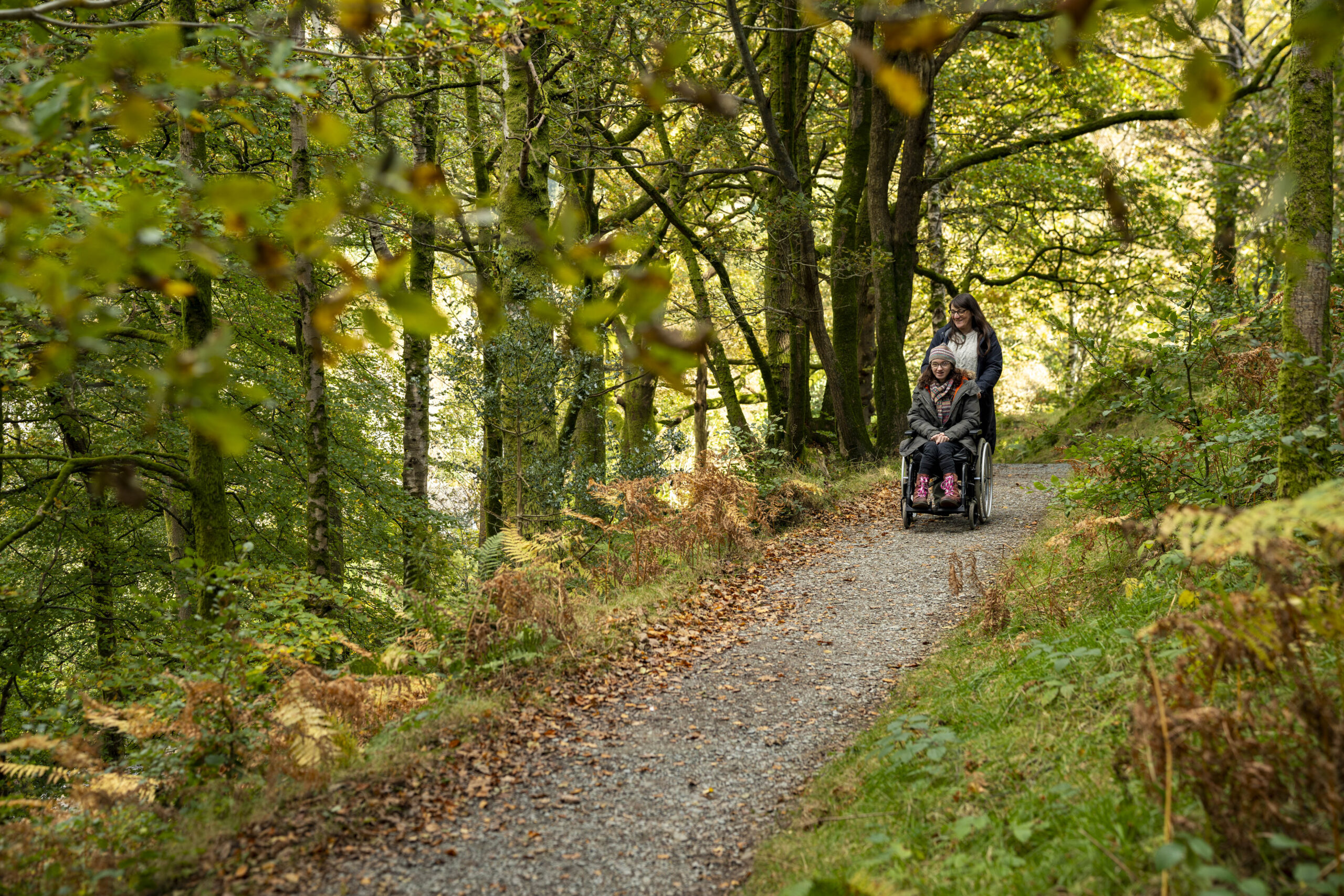
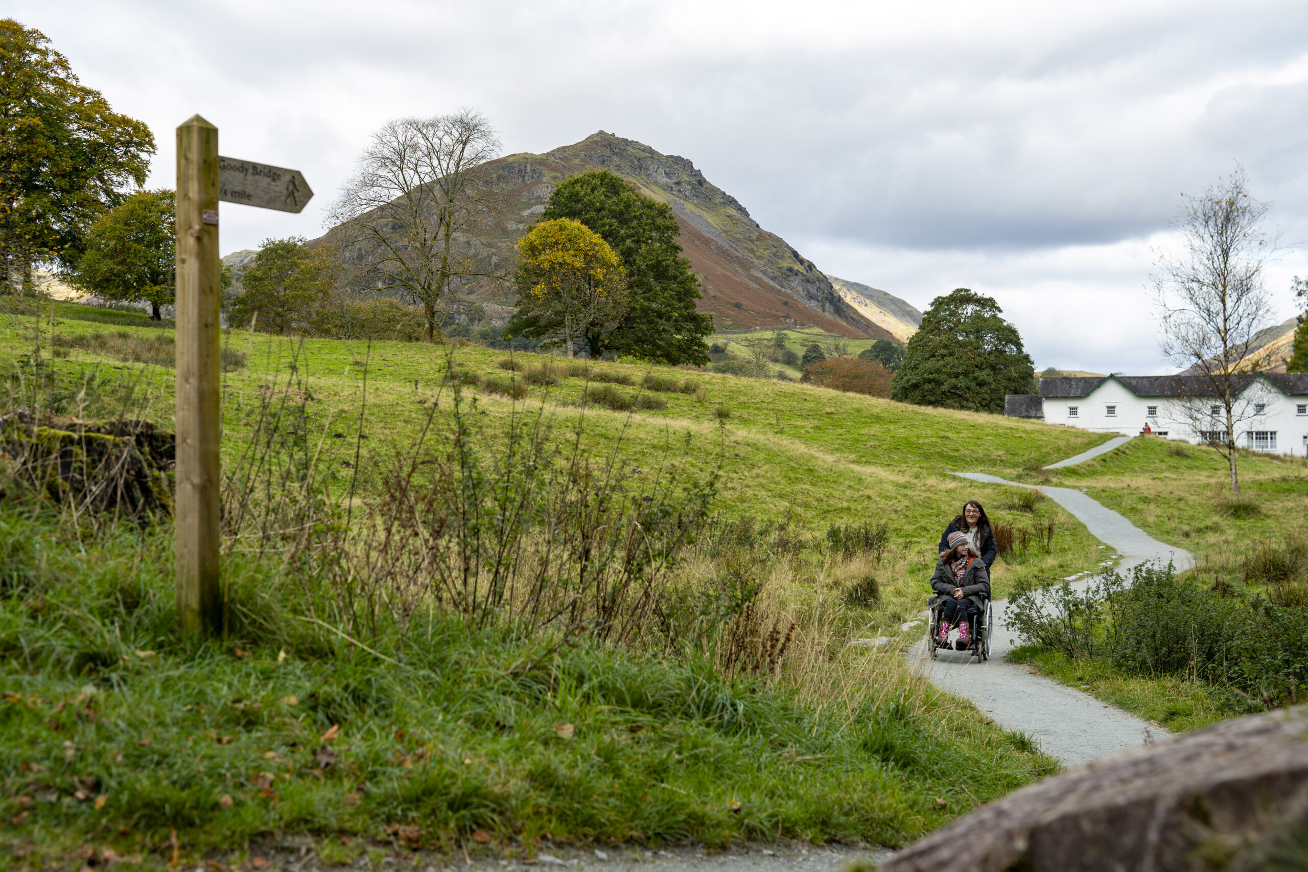
Route improvement: Access and accessibility improvements, small to medium
- Ambition: LDNPA to action at least 5 improvements per year to the rights of way network.
- Timescale: Within 5 years, subject to funding and landowner permissions
- Category: Local Route
- Partners: LDNPA
Route: Muncaster
- Ambition: Improvements to walking and cycling network as part of the Muncaster Whole Estate Plan.
- Timescale: Within 5 years, subject to funding and landowner permissions
- Category: Local Route
- Partners: Muncaster Estate
Route: Bassenthwaite
- Ambition: Improvements to walking and cycling network as part of the Higham Estate Whole Estate Plan.
- Timescale: Within 5 years, subject to funding and landowner permissions
- Category: Local Route
- Partners: Higham Estate
Route improvement: Forest trails
- Ambition: Work with Forestry England to improve and promote trails in and to their forests, including a new accessible route in Grizedale Forest.
- Timescale: Within 5 years, subject to funding and landowner permissions
- Category: Local Route
- Partners: LDNPA, Forestry England
Route: Keswick Crosthwaite Road
- Ambition: Implementation of walking route and junction improvement plan developed through ATE capability funding.
- Timescale: Within 8 years, subject to funding and landowner permissions
- Category: Local Route
- Partners: Cumberland Council
In addition to new active travel routes, the Network Plan identifies where route improvements and upgrades are required on existing footpaths, bridleways and multi-user trails.
Identified improvements range from small scale improvements such as replacing stiles and improving signage to larger improvements such as replacing bridges and upgrading surfaces.
66 route improvements were identified and categorised into the following:
- Route resurfacing = 21 improvements
- New or improved road crossing = 25 improvements
- New or improved signage = 8 improvements
- Improved maintenance = 3 improvements
- New or improved infrastructure (bridges, pavements) = 9 improvements
Next steps
Delivering the Network Plan will take time and require funding. Currently the Network Plan has no funding attached to it. But we are experienced in bringing in external funding to deliver active travel projects.
Potential funding could be sought from:
- Department for Transport, including via ATE if further capability funding were available or National Highways.
- UK Government regeneration and economic development funds as available, such as the Shared Prosperity Fund.
- Improvement and safety funds available through our LHAs, these would be particularly suitable for on road schemes that would be led by the LHA.
- Visitor giving and sponsorship through Lake District Foundation.
- Corporate sponsorship arranged through National Parks Partnerships.
- Heritage Lottery Fund.
- Developer contributions secured through planning applications.
- DEFRA grants such as those channelled through the National Parks such as Farming in Protected Landscapes and Access for All, if continued.
- Other business, legacy and charitable organisations with an emphasis on access, health, inclusion and accessibility.
Working in partnership with funded landscape recovery programmes where active travel development fits with their footprints and objectives.
It should be noted that this list is not exhaustive, and inclusion in this list carries with it no expectation of funding. Further work and partnership discussions will take place, and potential opportunities followed up.
Read the whole Network Plan
Supporting the Active Travel Network Plan are aims, objectives and supporting data. Use the links below to view the whole Network Plan.
Active Travel Network Plan was funded thorough Active Travel England Capability Funding. Read more about Active Travel funding on the GOV.UK website.