Lake District's historic landscape characterisation types
The Historic Landscape Characterisation project categorised the Lake District National Park into several broad landscape types, which are defined by their historical development, land use, and physical morphology. These types are grouped as follows:
Agricultural and enclosed land
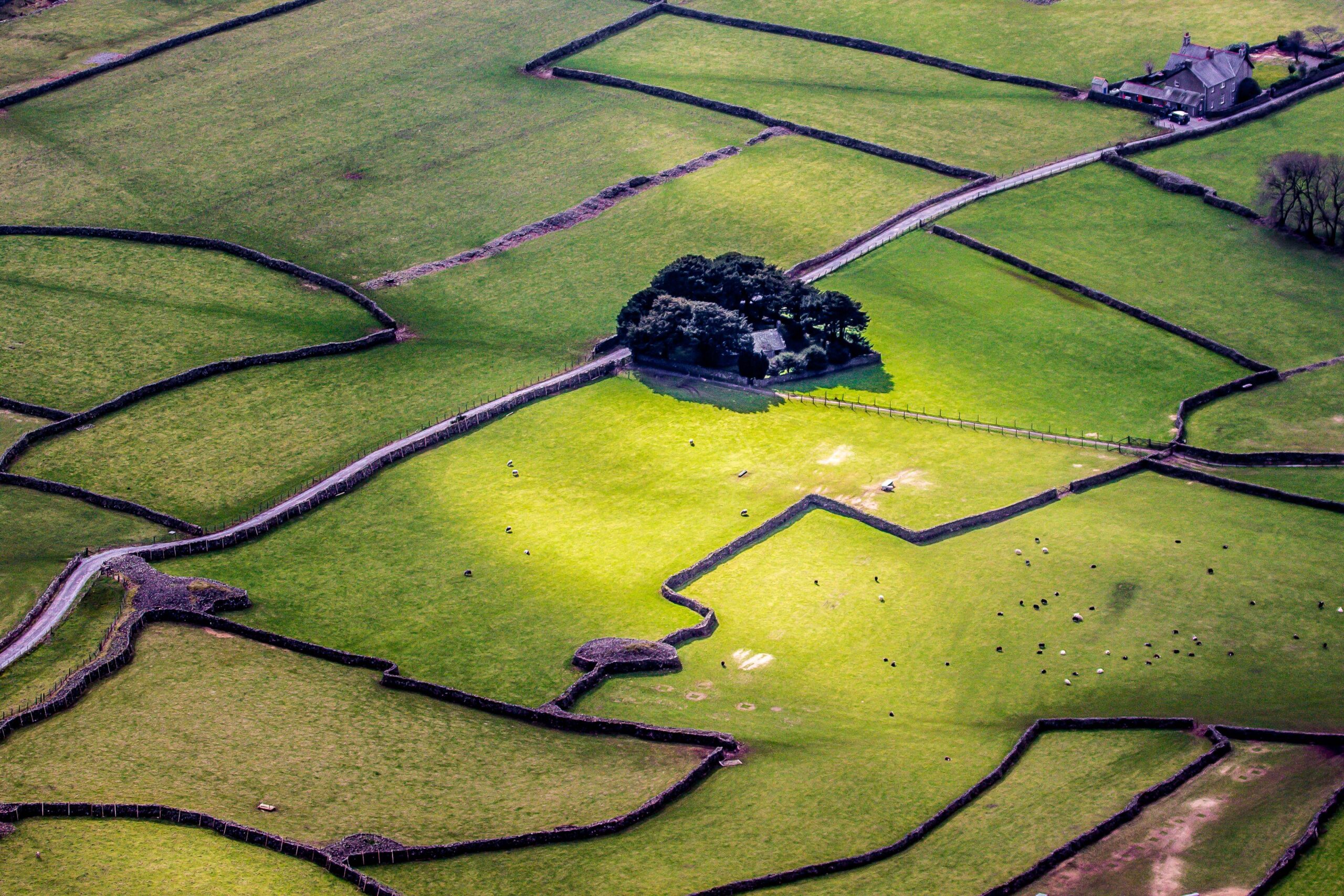
- Ancient enclosure: This refers to land that was enclosed prior 1770, representing about 30% of the National Park. It is often described as “Ancient Countryside,” appearing as an organic patchwork of fields that predates systematic planned enclosure.
- Discrete ancient farms: These are individual farmsteads surrounded by their own small, irregular field units, typically farmed as freeholds or leaseholds independently of a shared village system.
- Former common fields: These represent areas where land was once farmed in shared strips. They are identified by field boundaries that preserve the curved shape of former ploughed strips.
- Intakes: These are fields carved out of the open waste or fellside, often individually or in small numbers, to extend the cultivatable area of a farm.
- Planned enclosure: This landscape type consists of fields laid out according to a preconceived geometry, usually by professional surveyors during the 18th and 19th centuries. These are characterised by ruler-straight boundaries and regular plots, often created through Acts of Parliament or private agreements.
- Unenclosed land: Making up 38% of the park, this is land that was never fenced or walled for agriculture.
- Moorland: Defined as areas dominated by heath, heather, and unimproved grassland.
- Fell: Specifically refers to rock-dominated hillsides and summits.
- Coastal land: Low-lying maritime edges featuring mudflats, sand dunes, and saltmarshes.
Woodland and water
- Woodland: Divided into two distinct historical categories based on 19th-century map evidence:
- Ancient woodland: Woodland marked as broadleaf on the 1860s maps and not identified as a plantation; these are considered irreplaceable relicts of the original wildwood.
- Plantation: Woodland that post-dates the 1860s, is composed of conifers, or was explicitly labelled as a plantation on historic maps.
- Water: This type covers natural water bodies such as lakes and tarns, as well as man-made reservoirs created for industrial use or public water supply.
Human development and industry
- Settlement: Categorised by its physical arrangement and density:
-
- Nucleated Settlement: Groups of three or more houses, encompassing hamlets, villages, and towns.
- Dispersed Settlement: Isolated developments, such as individual farmsteads or single dwellings, which dominate much of the Lake District.
- Ornamental Parks and Recreation:
- Ornamental Parkland: Designed landscapes created by wealthy landowners, particularly in the 18th and 19th centuries, to enhance “Picturesque” vistas.
- Recreation: Land in modern use for leisure purposes, including golf courses, cemeteries, and caravan or camping grounds.
- Communications: This type identifies the network of public roads and railways that link settlements and industrial sites.
- Industry: Land primarily defined by extractive processes, such as large-scale mining and quarrying, which have left significant physical remains and spoil heaps on the fells.
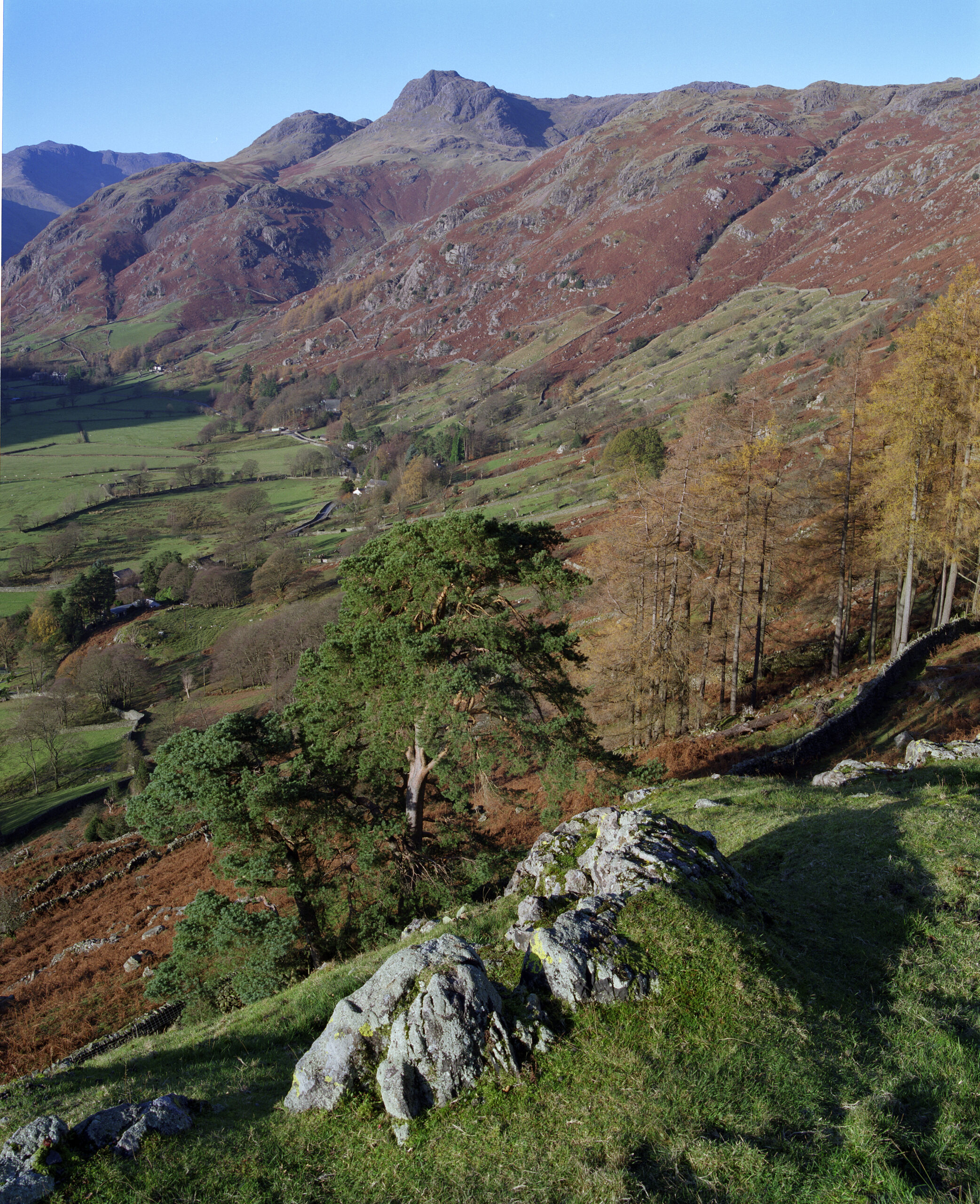
Great Langdale case study
The Historic Landscape Characterisation (HLC) for Langdale was developed to show how a broad-brush regional study can be enhanced by integrating more detailed, site-specific research. In this instance, the National Trust, the valley’s primary landowner, provided a detailed landscape study that allowed researchers to refine the standard HLC data. The process involved using (GIS) to compare modern mapping with the Ordnance Survey first edition maps of the 1860s to create a snapshot of land use change. Researchers used four interpretation layers to track the valley’s evolution, though it was suggested that up to ten layers would be needed to fully capture the complex history from prehistoric times to the present day.
Time depth
The history of Great Langdale spans thousands of years of shifting human priorities:
- Prehistoric industry: For approximately 1,000 years until roughly 2,000 BC, the central fells were an international centre for Neolithic stone axe production.
- Medieval foundations: By 1216, the valley already possessed a ring garth—a boundary separating cultivated land from the fells. During the 12th and 13th centuries, medieval farmsteads like Robinson Place and Middlefell Place were established as encroachments into the former forest.
- Tudor expansion: The 16th century saw a surge in population, leading to extensive “intaking,” where farmers improved and enclosed small, irregular patches of the lower fellside.
- The age of improvement: In the 17th and 18th centuries, prosperous “statesmen” farmers consolidated land and created formal cattle pastures. The enclosure of the valley bottom was finally completed by the 1853 Parliamentary Enclosure Act.
The physical palimpsest
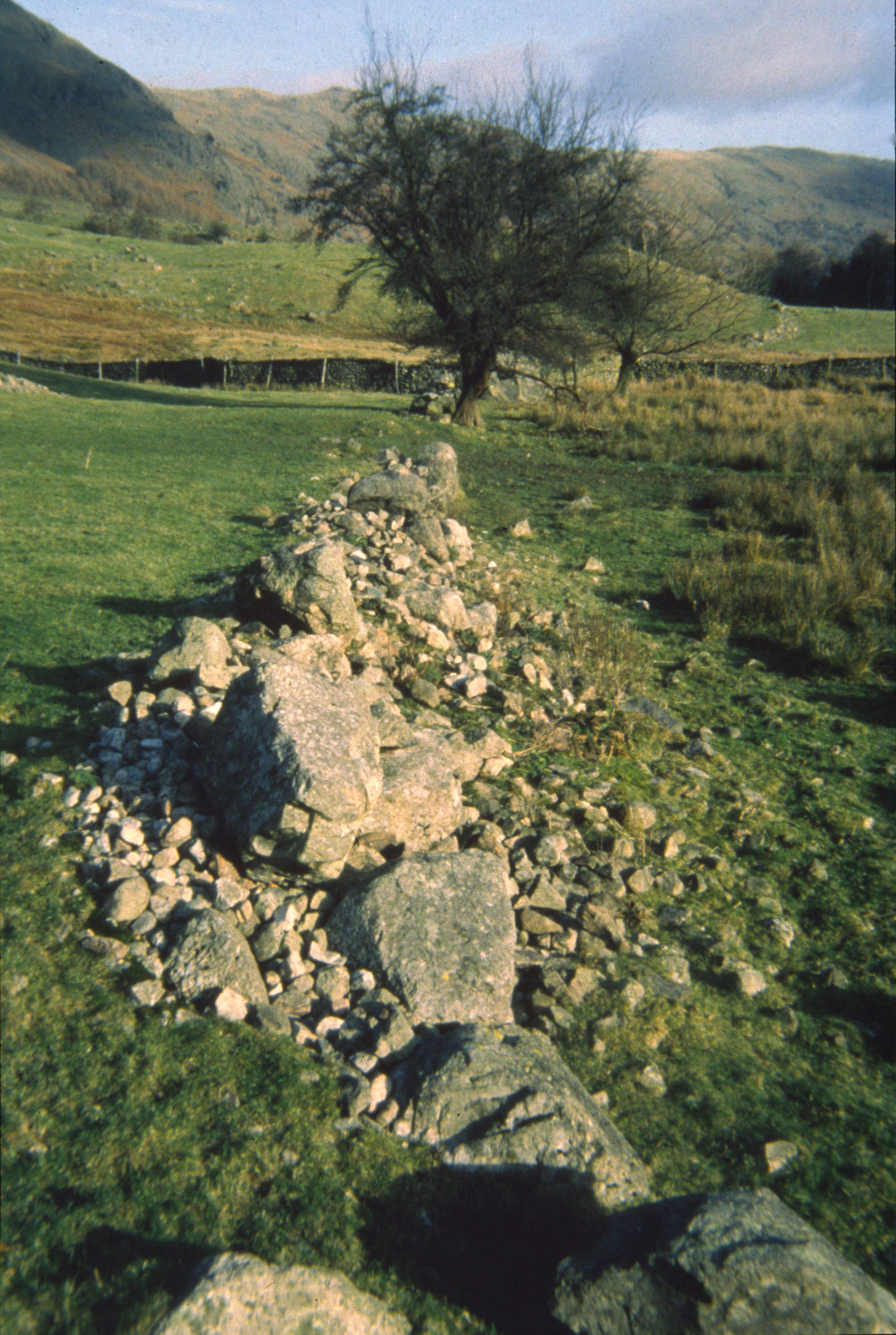
- The Ring Garth: This medieval “head dyke” is a permanent boundary wall that remains traceable today near farms like Stool End and Wall End.
- Pollarded ash trees: A vital historic feature, these trees were planted in rows along boundaries and cropped every 12 years to provide emergency winter fodder for livestock.
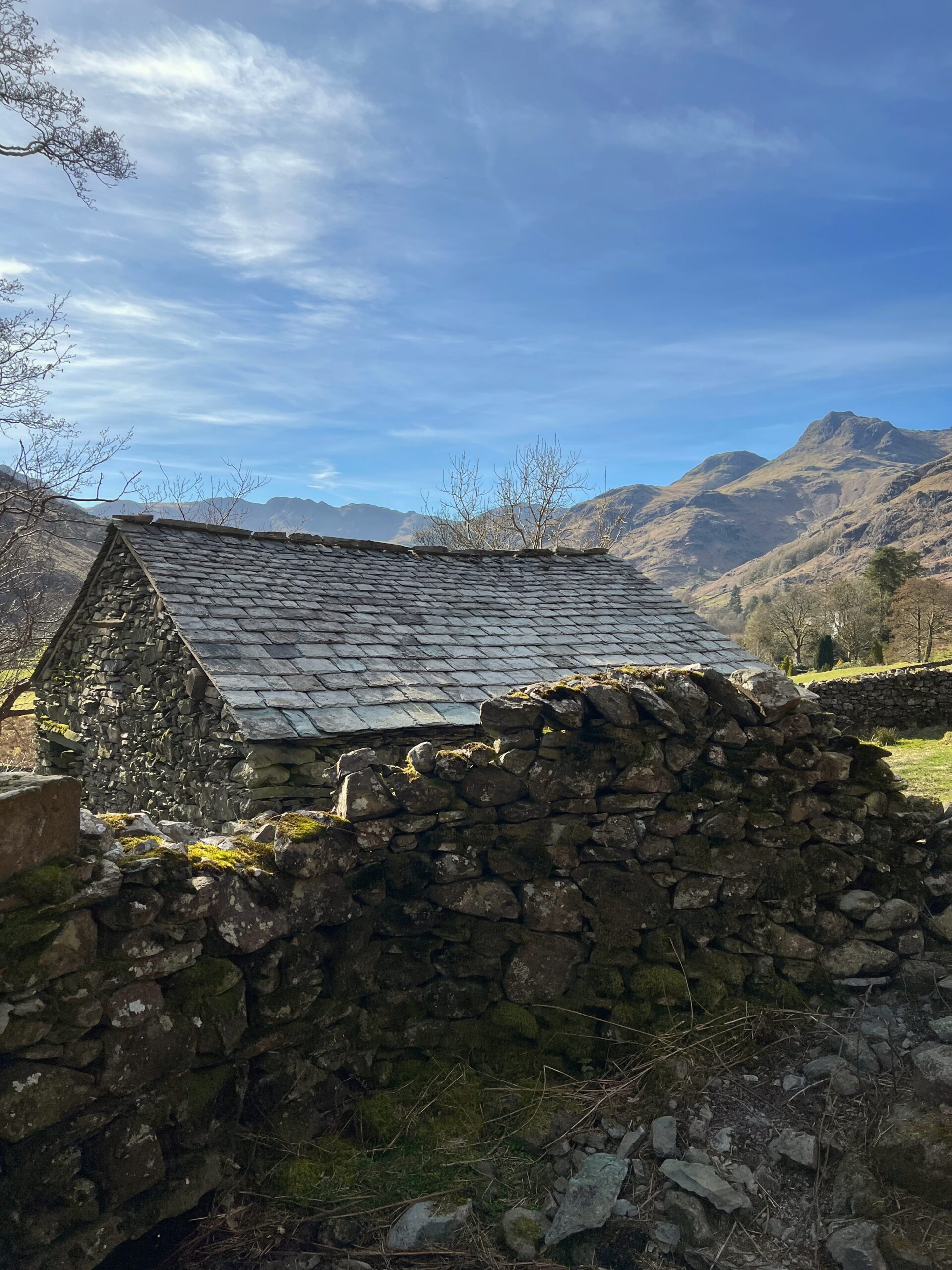
- The six National Trust farms: The landscape is anchored by six tenanted farms: Harry Place, Robinson Place, Millbeck, Middle Fell, Stool End, and Wall End.
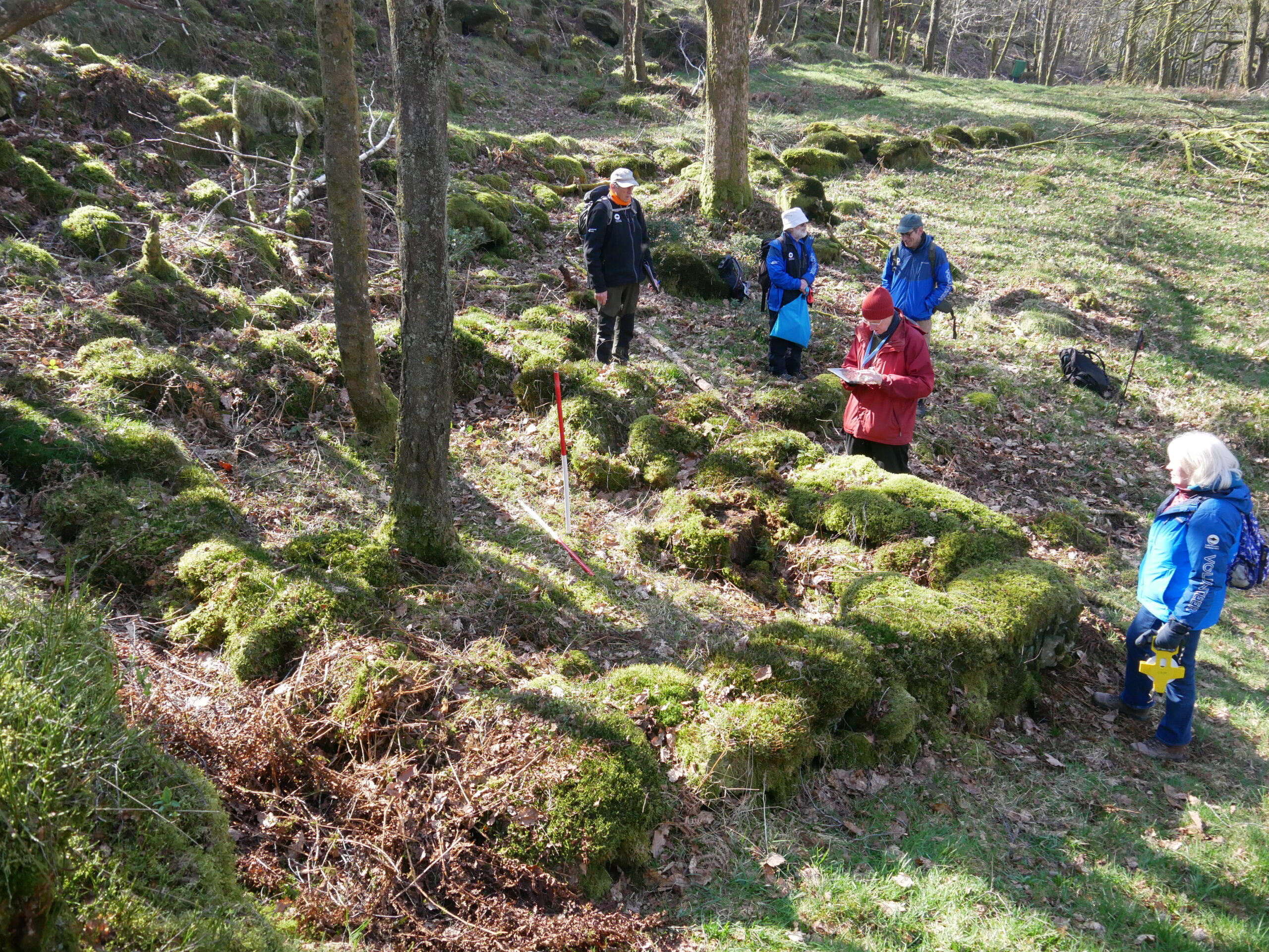
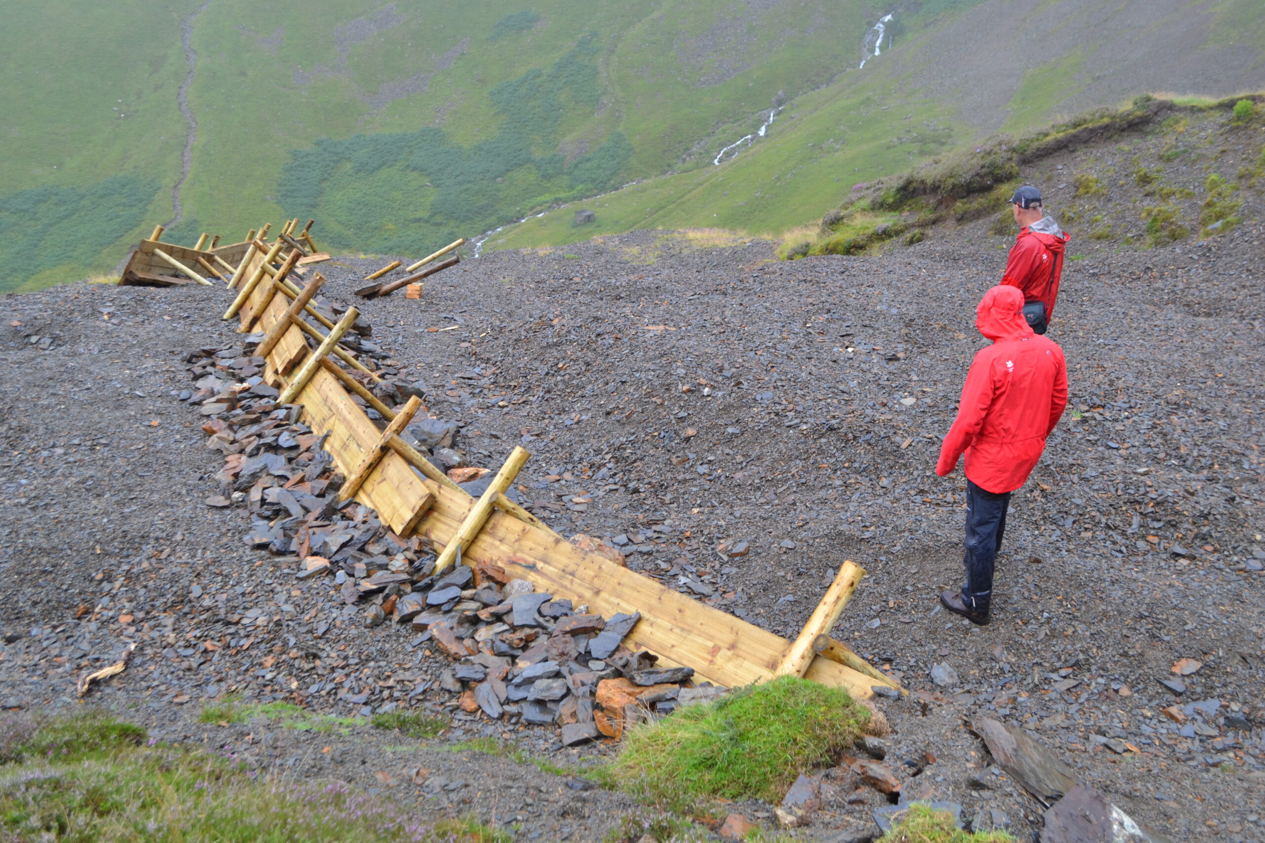
- Axe factory sites: The high central fells contain massive amounts of debris from Neolithic quarrying that still shape the appearance of the fellside.
- Industrial Relics: The landscape contains hidden evidence of its industrial past, including charcoal pitsteads used for fuel production and former iron ore mines.
- Boundary composition: The valley floor is distinguished by hedgerows (roughly 60% hawthorn), while the higher ground is defined by drystone walls.
Future character
To this day, Great Langdale contains a number of physical features and attributes which can be maintained through land management and planning to ensure that its historic landscape characters persists. The project recommended that:
- Efforts should be made to retain smaller, irregular fields and their associated “field furniture,” such as gate stoops, smoots, stone stiles, and hog holes, which are vital to local distinctiveness.
- Management should prioritise reconstructing drystone walls using traditional techniques and locally sourced stone.
- Conservation plans should encourage ghyll and beck-side planting, as these areas contribute significantly to both landscape character and biodiversity.
- Future management must include monitoring the condition of hedgerows in the valley bottom as, without active management like hedge-laying, these features will degrade into isolated trees leading to a significant loss of character within decades.
- Traditional management techniques, such as pollarding ash trees for winter fodder, should be reintroduced or maintained to preserve the valley’s cultural and economic history.
Find out more
The Historic Landscape Characterisation report and mapping data is available from the Lake District National Park’s Historic Environment Record upon request. Licensing and charging may apply. Further information on these can be found on our Historic Environment Record page.
Please contact archaeology@lakedistrict.gov.uk (opens email) for more information.