Wasdale
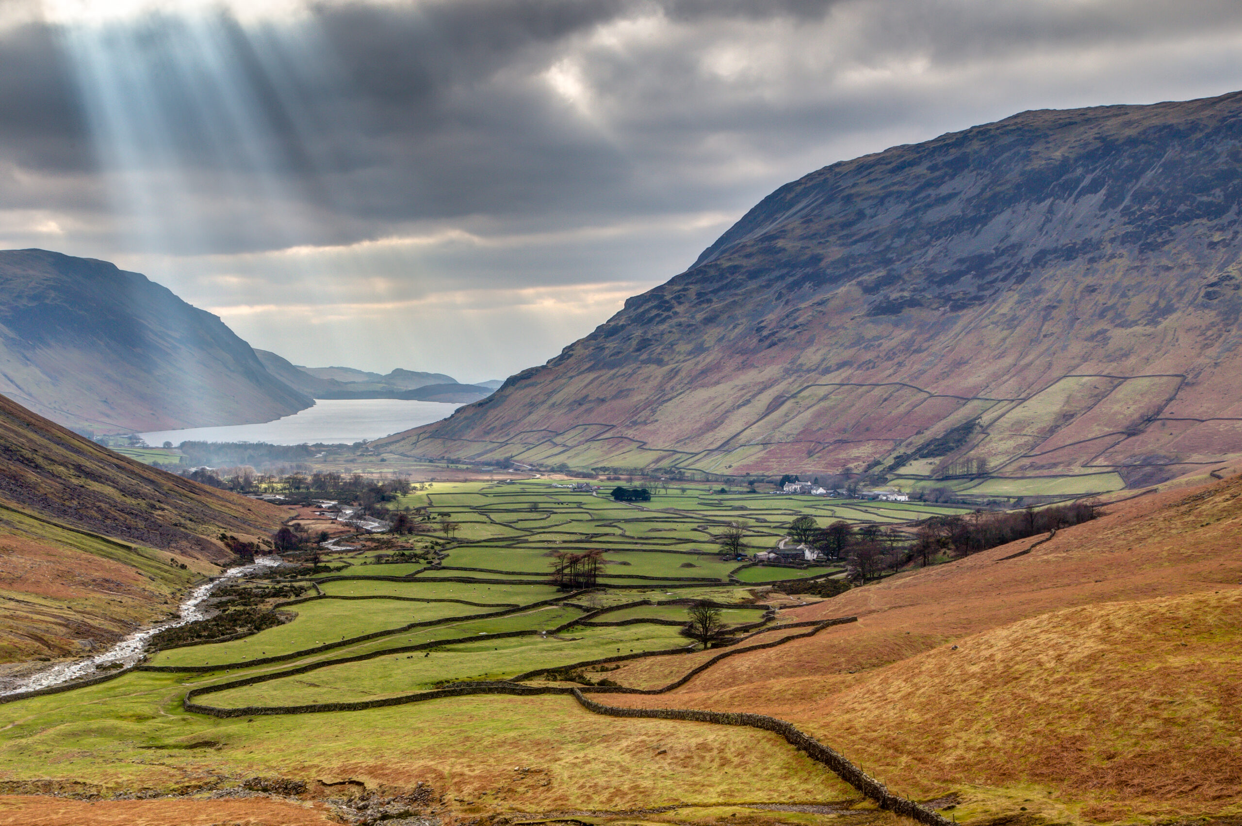
This typically dramatic Western Lake District landscape shows the flat valley bottom at the head of Wasdale. The photo below is taken at the bottom of Wasdale Fell. At the far end of the lake is the small hamlet of Wasdale Head which has a pub, a few B&Bs, a hotel and a couple of farms. The valley only has one road in and out; it is in effect a dead end. The valley is dominated by Wastwater, which is England’s deepest lake (74m).
The nearest primary school to Wasdale is Gosforth CE School (9 miles away) and the nearest town is Egremont (13 miles away), which has the local secondary school, West Lakes Academy. Gosforth CE School is a small school with just 115 pupils. There is a campsite at the northern edge of Wastwater. England’s smallest chapel is surrounded by trees in the middle of the fields in the valley bottom. The famous fell runner Joss Naylor came from the Wasdale valley.
Wasdale is surrounded by mountains. Yewbarrow (628 m) is visible on the right and Illgill Head (609 m) is visible on the left. Lingmell Beck, which flows into Wastwater, is visible on the lefthand side of the photo. Lingmell Beck shows examples of both stream braiding and a meander. The mountains in the photo are volcanic in origin and are the outcome of glaciation during the last Ice Age which ended about 10,000 years ago.
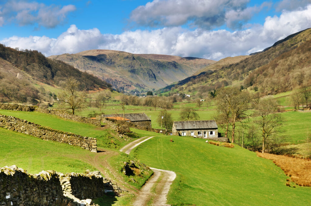
The photo shows how dry-stone walls are used to divide up the farming landscape. The fields around the farm in the valley bottom are known as in-bye fields, whereas the fields up the fellside have been ‘taken’ from the fell and are known as in-take fields. The land above the highest wall is the open fell.
Wasdale is the main access point to England’s highest mountain, Scafell Pike (978m) and sits at 80m above sea level. The brown colours in the scene suggest the photo was taken during the autumn. The orange/brown vegetation is bracken, a fern which has grown up in areas where trees would once have been. The shrubs near the river are gorse.
Many of the older Cumbrian buildings are white because houses and farms used to be treated with red lead and then lime washed, which whitens, to keep out the damp. Many homeowners today have perpetuated the tradition of painting their houses white.
Grid reference of Wasdale Head: NY 187088
Important vocabulary
meander, scree, hamlet, valley bottom, dry stone walls, fell, mountain landscape, beck, braiding
Discussion starters and questions
- What jobs/leisure pursuits might the people who live there have?
- How far do you think it might be to the nearest school or town?
- Why would tourists come to this mountain area?
- What would you expect the climate to be like in this mountain area?
- Choose 2 unusual features from the picture to talk about.
- Talk about the streams that you can see in the photo.