


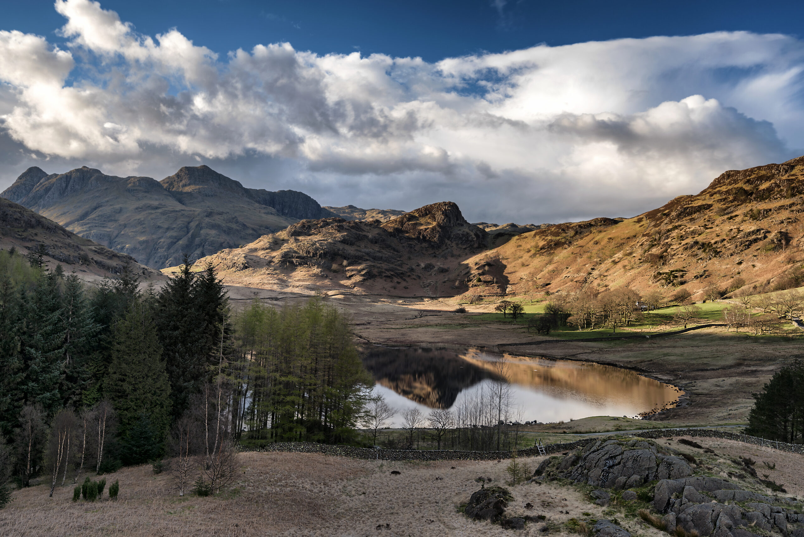
Blea Tarn
![]()
This linear path (1.5km each way) provides a real upland experience and amazing views of the Langdale Pikes.
OS Explorer Map OL6
Route for challenging. 3km distance.
MWS Grade
Challenging
Duration
0.5 hours
Distance
1.42km / 0.88miles
Route
Cross the road from the car park and go through the gate opposite. The initial slope from the car park is around 1:5, so you may wish to get dropped off on the roadside, so you can avoid this steep car park section. Follow the good, compacted stone path towards the tarn. You are in the heart of the dramatic central Lakeland fells, with Lingmoor Fell on the right and the crags of Pike o’ Blisco on the left, framing the famous Langdale Pikes. For views alone, this is a route to keep for good weather.
The path drops down to the tarn’s outflow and crosses it by a wooden footbridge. Bear uphill and right, into the small woodland of larch, Scots pine and silver birch. There are benches along this section to rest and picnic.
The path leaves the woodland on a section created by the Fix the Fells programme, which winds through the open fell side back to Blea Tarn road, north of the tarn. This section becomes much rougher and rockier for most of its length, with some steep sections of 1:6 gradient, which is currently too rough for most wheeled equipment.
Please note that mobility scooters must be class 2 or 3 on the route.
Details
Start point:
National Trust car park
Postcode: LA22 9PG
Grid reference: NY 295043
W3W: ///clincher.coveted.snack
Turning point:
Grid reference: NY 289051
W3W: ///diets.faster.blows
Facilities:
None on route
Getting there:
Bus: None to the start of the route. The nearest bus stop is at the Old Dungeon Ghyll for the 516 Langdale Rambler service.
Car: B5343 through the Langdale valley. A sharp, left hand bend after the Old Dungeon Ghyll signals the start of the steep 1:4 climb up to Blea Tarn.

