Swirls Trail, Thirlmere
![]()
A short route with excellent views of Thirlmere Reservoir, recently improved and extended.
OS Explorer Map OL5
Route for many. 1.4km distance.
MWS Grade
For many
Duration
1.0 hours
Distance
1.4km / 0.9miles
Route
The route begins at the main Swirls car park where there are approximately 60 parking spaces. This is a pay and display car park with accessible toilet facilities. The car park does get busy in peak seasons as it is a popular start point for people wanting to climb Helvellyn, amongst other local fells.
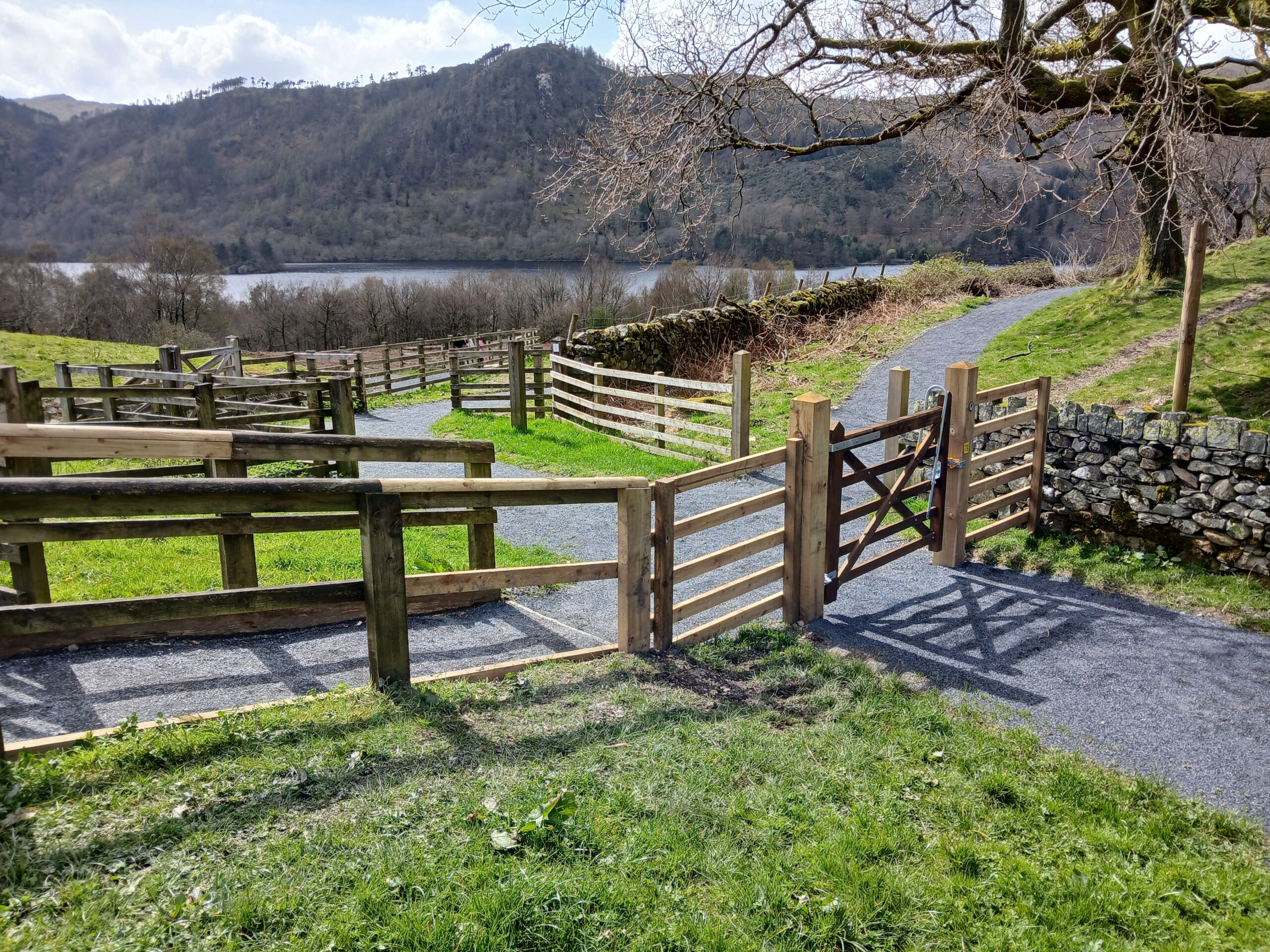
From the main car park head to the Northern corner where there is a large field gate and an accessible wicket gate along side it. There is a Miles Without Stiles roundel on the gate post next to the wicket gate. Head through the wicket gate leading onto a main stone surfaced track. This heads slightly downhill for approximately 70m before turning to the left and going slightly uphill towards an underpass under the A591. The surface turns from stone to tarmac for a short section here. When at the underpass, go through a wicket gate next to a field gate and go through the underpass. Once through head along the track for another 35m before there is a fork in the track. At the fork in the path take the right-hand fork which turns up a steeper slope back towards the A591. Do not continue straight on down towards the reservoir here, as this is not accessible for many users.
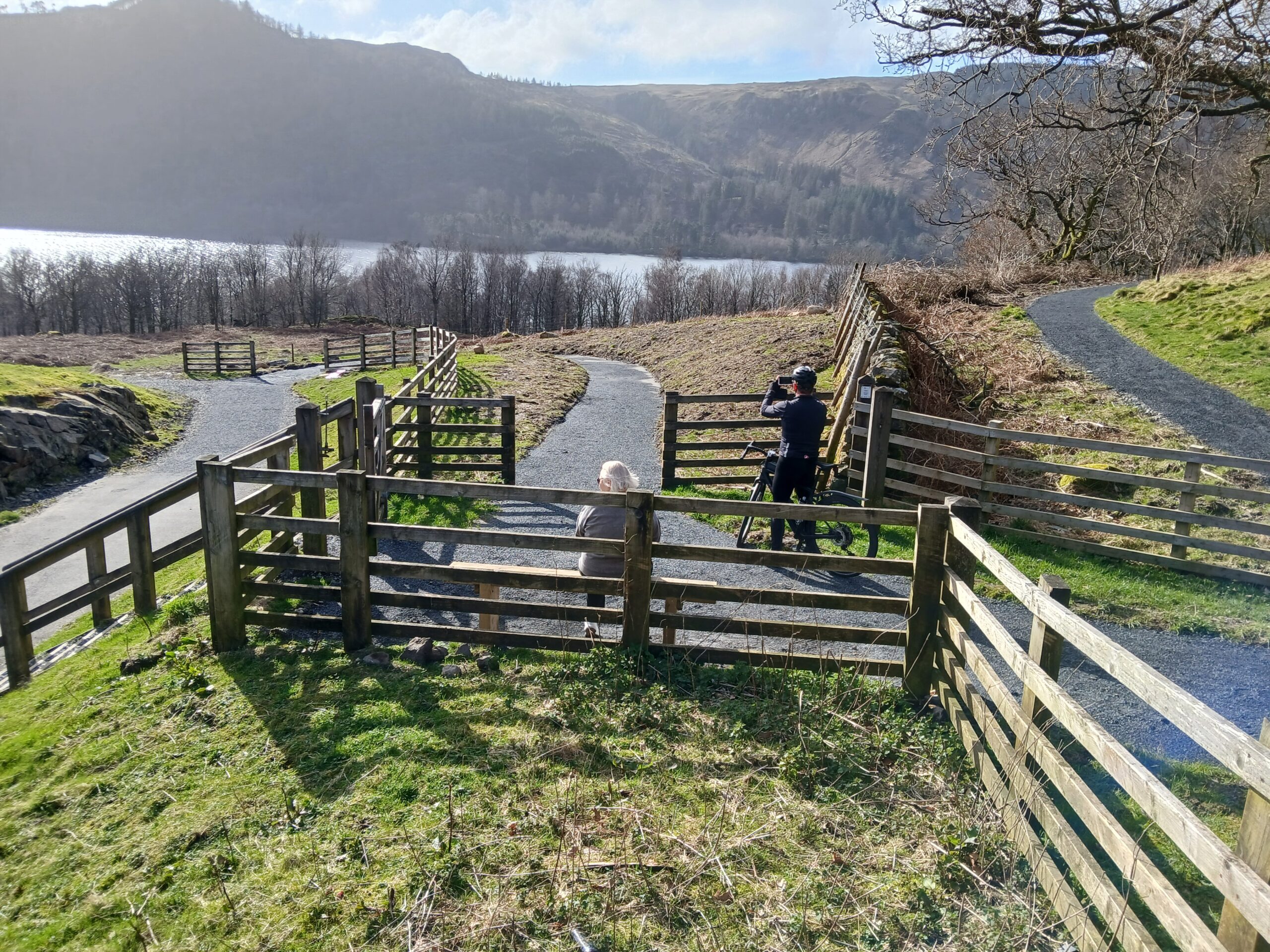
As you go up the ramp which is a rolled stone surface, there is a rest point with a perch style bench at the top which is approximately 215m from the start point. From here the path turns back towards the reservoir through a gap in the stone wall which takes you onto a stone surface path into the woodland of Station Coppice. The route undulates along a well surfaced path, including a very short section with a 1:9 gradient, and finishes at an accessible picnic bench with a good view out across the Thirlmere Reservoir, approximately 400m from the start point. There is a signpost informing you that this is where the accessible part of the route ends, as the footpath does continue beyond this point, but the surface is uneven and steeper from here on. The fells of High Tove, High Seat and Bleaberry Fell can be seen across the water.
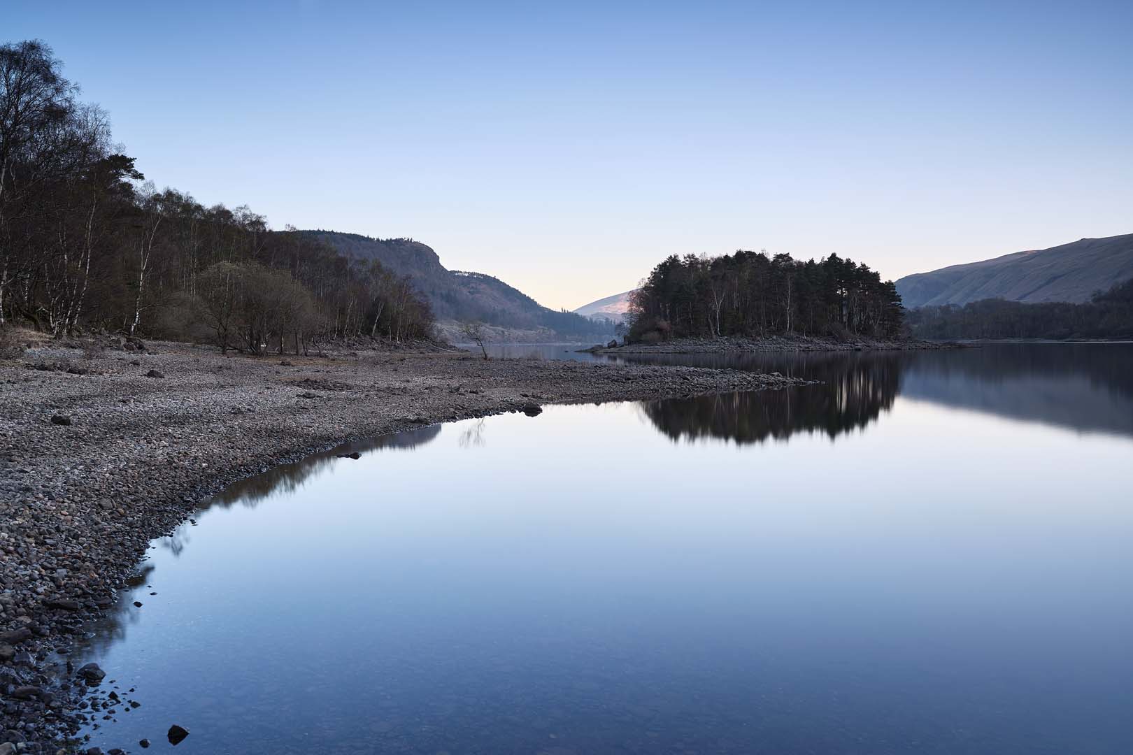
Thirlmere was created as a reservoir in the late Victorian era. Previously, two small tarns, Leathes Water and Wythburn Water, were connected by a stream and small causeway bridge. They all disappeared, along with a hamlet and pub, when the valley floor was flooded.
Please note that mobility scooters must be class 2 or 3 on the route.
Details
Start point:
Swirls car park
Postcode: CA12 4TN
Grid reference: NY NY316169
W3W butchers.words.sped
Facilities:
Accessible toilets at United Utilities Swirls car park (Radar key required for disabled toilet).
Getting there:
Bus: Station Coppice, the 555 Kendal to Keswick service runs along the A591 all year round and stops at Swirls. Car: For Station Coppice A591 from Keswick or Ambleside to Station Coppice car park (on Northbound side) or Swirls car park (Southbound).