Plans frequently asked questions
It is important that planning applications include clear, scale plans ,which have been drawn to a good standard so that everyone who is a part of the process can have confidence in what is proposed. This includes us, interested neighbours, consultees, and builders who may have to build out any permission. We will not validate your application unless it has enough plans to show the existing site, and the site as proposed. What plans we require will vary from scheme to scheme. Examples of different types of plans are detailed below.
Plans do not necessarily need to be professionally drawn, however they must meet certain minimum standards. All plans must be drawn to metric scale. If your plans do not meet our minimum standards we will not validate your application.
If you are submitting your application on paper, by law we require a total of four copies of all plans.
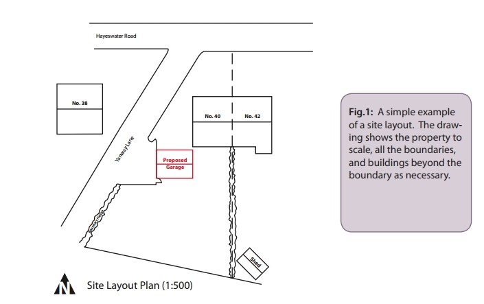
The site layout plan (also known as a block plan) should be drawn at a metric scale and should accurately show:
- the direction of North
- the proposed development in relation to the site boundaries and other existing buildings on the site
- all the buildings, roads and footpaths on land adjoining the site including access arrangements
- all public rights of way crossing or adjoining the site
- the position of all trees on the site, and those on adjacent land that could influence or be affected by the development (see our tree guidance note for more details)
- the extent and type of any hard surfacing
- boundary treatment including walls or fencing where this is proposed
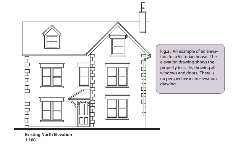
Elevation drawings should be drawn to a scale of 1:50 or 1:100 and must clearly show the proposed works in relation to what is already there. All sides of the proposal must be shown. They should indicate, where possible, the proposed building materials and the style, materials and finish of windows and doors. Blank elevations must also be included, if only to show that this is in fact the case.
Where a proposed elevation adjoins another building or is in close proximity, the drawings should clearly show the relationship between the buildings, and detail the positions of the openings on each property.
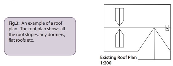
A roof plan is used to show the shape of the roof. These should be drawn to a scale of 1:50 or 1:100 and show clearly the proposed works in relation to what is already there. Details such as the roofing materials and their location are typically specified on the roof plan.
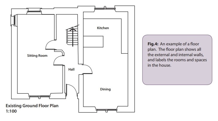
Floor plans should be drawn to a scale of 1:50 or 1:100 and should explain the proposal in detail. Where existing buildings or walls are to be demolished these should be clearly shown. The drawings submitted should show details of the existing building(s) as well as those for the proposed development. New buildings should also be shown in context with adjacent buildings, including property numbers if necessary.
-
Changes to ground levels are proposed (infill or excavation)
-
The proposed development will not be built on the existing ground level
-
The existing ground level is not flat
-
Below ground works are proposed (e.g. basements or trenched services)