


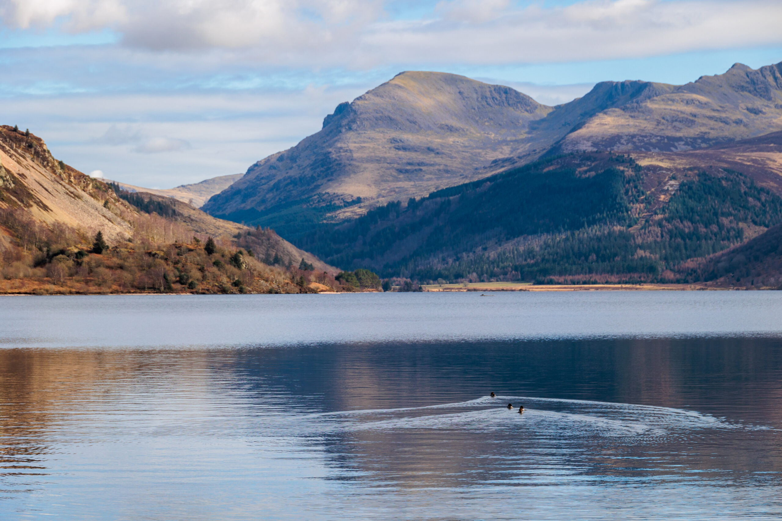
Ennerdale Views
![]()
A 2km loop ‘for all’ and a longer 4.2 km level walk ‘for many’ along Ennerdale Water’s western shore with fantastic views of the wild Ennerdale fells.
OS Explorer Map OL4
Route for many. A circular walk. 2km distance.
MWS Grade
For many
Duration
1.5 hours
Distance
3.2km / 1.99miles
Route
Route for all (currently only ‘for some’ standard). A circular walk. 2km distance.
Leave the back of the car park (near to the Ennerdale information signs) and follow a well surfaced lane down to Ennerdale Water. Turn left and cross the bridge over the weir.
The path weaves through gorse bushes (watch out for yellowhammers in spring and summer) before it nears the shoreline again. Angler’s Crag is on the right and, far up the valley, are the high hills of Haycock, Scoat Fell and Steeple.
As you approach the wooden footbridge, the wheelchair route for all swings round to the left and away from the lake. After 300m go left into Broadmoor Plantation. This new path, winding through thickets of young birch, takes you back to the car park but avoids most of the tarmac road.
Route for Many (currently out of condition due to repeated flood damage). A linear walk 4km return distance.
This route is currently not suitable for those on wheels, due to flood damage causing steps and washouts on approaches to bridges. Follow the route for all as far as the second footbridge, from here the route suitable ‘for many’ carries on alongside the lake for 1.2 km and leads you to a grassy picnic spot overlooking the lake. This is the site of the old Angler’s Hotel, demolished to raise Ennerdale’s water levels. From here, the path continues eastwards above the lakeshore. It is flat and robust, so all terrain or motorised wheelchairs should find it accessible. The path takes a sharp right turn (grid reference NY 101162) and descends gently to finish right at the shoreline.
You can now also get through to Bowness Knott Car Park and MWS route 24 via a ‘challenging’ grade slope (1:5 but tarmac).
Please note that the map below is out of date. The description above is accurate.
Please note that mobility scooters must be class 2 or 3 on the route.
Details
Start point:
Bleach Green car park
Postcode: CA23 3AL
Grid reference: NY 085153
W3W: ///rinse.gasping.dimension
Facilities:
None on route. Nearest in Ennerdale Bridge which has two pubs and the Gather Ennerdale community centre with toilets and a café.
Getting there:
No direct public transport. Car: A5086 from Cockermouth, left (grid ref. NY 073194) to Ennerdale Bridge. Follow signs to Ennerdale Water. From the south follow A595 and A5086 to right turn for Ennerdale Bridge (grid ref. NY 027145)

