
Burst river bank at Mill Beck, Footpath 220011, Buttermere and Brackenthwaite Parish
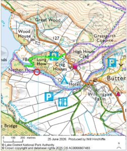
Location: Grid reference: NY 1700 1710, nearby What 3 Words reference: lawful.shimmered.fake
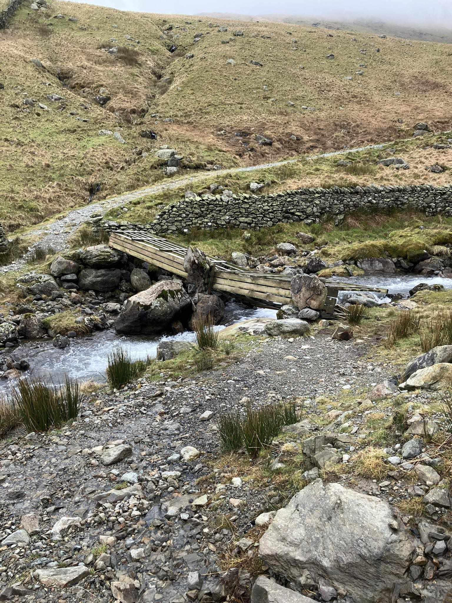
Details of issue: The river at Mill Beck on the footpath between Buttermere village and Nether How / Crummock Water has burst its bank, and is currently running across the footpath into the field.
Alternative routes: At some times the water levels in the breached beck may be fordable for those with suitable footwear (or barefoot), please take care if choosing to do so. Alternatively footpath 220012 / the path from the National Trust car park to the northwest of the village can be used to reach Nether How and the lakeshore.
Plans to address issue: We are engaging with the landowner, West Cumbria Rivers Trust and Environment Agency around the long-term plans for the river here, and whether a diversion of the footpath may be necessary to facilitate a long-term change to the route of the beck, or whether installing a new bridge (or stepping stones) is the best approach to reinstate access
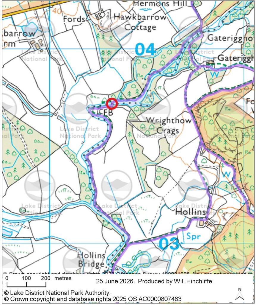
Bridge over the River Irt, Footpath 409052 / 419049, Gosforth and Wasdale Parishes
Location: Grid reference: NY 1032 0371, nearby What 3 Words reference: guidebook.sweetened.resemble
Details of issue: In December 2025 the Secretary of State confirming a Definitive Map Modification Order adding a footpath alongside and across the River Irt from Gaterigghow Bridge to near Hollins Bridge. In 2021 a bridge, a bridge forming part of the route of this path was removed by the landowner (National Trust) as it was unsafe. It is therefore not currently possible to cross the River at this point.
Alternative routes: There is no suitable alternative route nearby
Plans to address issue: We will be working with various parties (including the National Trust) on how to resolve this issue
Memorial Bridge over River Liza, Footpath 407033 Ennerdale and Kinniside Parish
Location: Grid reference: NY 1757 1318, nearby What 3 Words reference: hushed.newlywed.legroom
Details of issue: We have had to remove the ‘Memorial Bridge’ over the River Liza in Ennerdale, which is crossed by Footpath 407033. The bridge was blown over and off its abutments during Storm Éowyn in January 2025, and sustained significant damage in the process.
Alternative routes: The most direct alternative routes for users wishing to cross the river are via the bridleway (407021) along the northern side of the river, or the forest track adjacent to the river on its southern side to reach the crossings at ‘Middle Bridge’ approximately one kilometre west-northwest of the closed bridge or (via the bridleway) the bridge southeast of Black Sail Hut.
Plans to address issue: We intend to replace this bridge as part of our bridge work programme when sufficient funding can be identified.
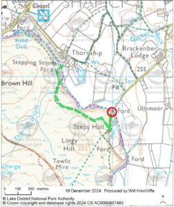
Stepping stones over the River Lowther, Footpath 361020, Steps Hall, Shap Rural Parish
Location: Grid reference: NY 5600 1373, nearby What 3 Words reference: skips.bullion.cube
Details of issue: Some of the stepping stones have shifted leaving wider spaces between them, and some are wobbly.
Alternative Routes: There is an alternative set of stepping stones at Thornship to the northwest.
Plans to address issue: The stepping stones will need to be inspected by our Ranger team and works to re-set the stones prepared as part of their work programme.