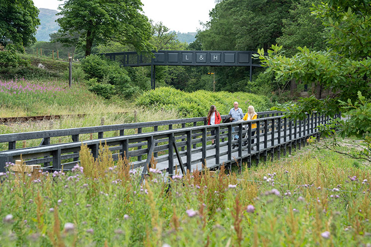

| This route takes you between Newby Bridge to Lakeside YMCA via Lakeside Ferry Terminal and Finsthwaite, OS Explorer Map OL7. Some sections of the route (4.5km) are suitable for many. Some sections of the route (1.5km) are suitable for some. Route: 6km distance |
The West Windermere Way traces the rugged shores of Windermere and meanders among its quiet woodlands. At 6km this is one of our longer routes, with sections of Miles without Stiles that are for some or for many. We enjoy the variety of this trail, with landscapes that change at the turn of a corner. And by leaving the car behind you can enjoy some of the best countryside around Windermere. Read on for further details.
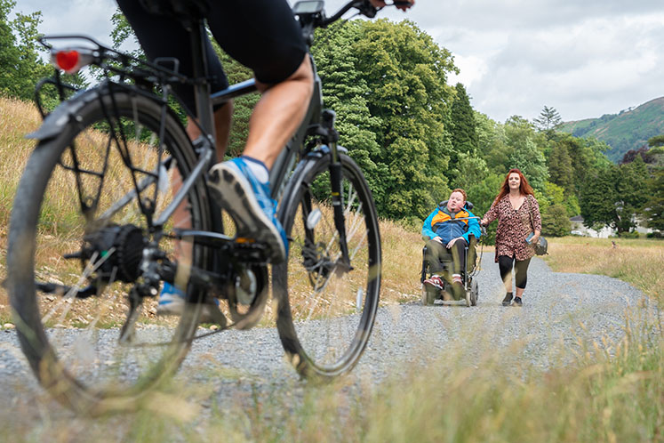
A 1.5km section of the West Windermere Way is an accessible Miles Without Stiles route - Miles Without Stiles 51.
Link with the bus stop at Newby Bridge, or Newby Bridge station halt and then join the route from the Swan Hotel. The trail leads away from the River Leven through wide open parkland where there is plenty of opportunity to relax and take in the fresh air. At the foot of Windermere there are striking views across the reed beds and woodland to Gummer’s How. In the evening, and if they are around, the local bats provide spectacular entertainment.
All of the route can be used by walkers and some sections can also be used by horse riders and cyclists. Horse riders please note that the route alongside the railway approaching Lakeside is only for pedestrians and cyclists. To reach Lakeside, horse riders must follow the signs towards Landing Knott Wood and join the road there where you can explore other footpaths leading to Finsthwaite and Newby Bridge. Join these in Landing Knott Wood, across the road. The route picks up the Lakeside and Haverthwaite Railway, following it all the way to the busy Lakeside ferry terminal. You could also start the trail here (Start Point 2).
From the Lakeside Pier ferry terminal, the route heads on through the trees towards the sleepy village of Finsthwaite nestling in the hills. Roads around here are narrow and can be busy. Please take care. If you are heading north, you need to cross a busy road to follow the West Windermere Way across the field and into the woods. There are other footpaths leading to Finsthwaite and Newby Bridge. Join these in Landing Knott Wood, across the road from the Lakeside Pier road entrance. Or why not catch a steam train or ferry to other destinations in the area?
Cyclists and horse riders please note: please use the first section of the trail here, but you must follow the signs to join the road at The Knoll. Continue past the Stott Park Bobbin Mill and look out for signs to re-join the West Windermere Way at Black Hole Wood.
The quiet woods to the west of the lake were once managed as plantations, and now red squirrels make their home here. The plantations provided wood to make bobbins, and the trail passes close to the Stott Park Bobbin Mill. The last working bobbin mill in the Lake District is well worth planning some extra time to visit. An artificial lake at High Dam was created to feed the machines at the mill, and you can take a detour here to explore the superb scenery. The footpaths around High Dam lead over the fells to the farming villages of Rusland and Satterthwaite. This section of the route can only be used by walkers, and this includes access to High Dam and the path towards High Stott Park.
On the east-bound section of the trail, cyclists and horse riders must follow the alternative route along the road. This follows a short section of road and rejoins the trail at Black Hole Wood. A gentle section leads downhill from the wooded fells through fields to High Stott Park where it crosses the road and into more plantation woodland. Local schoolchildren planted hedgerows along this section of the route to provide food and shelter for bugs and birds. The final destination is the shore of Windermere at YMCA Lakeside, for now. You could also start the trail here (Start Point 3).
We will eventually extend the accessible routes all the way up to Wray Castle. Check the West Windermere Project page for progress updates.
Newby Bridge Bus Stop
Postcode: LA12 8NA
Grid reference: SD 369 863
W3W: coming soon
Lakeside Ferry Terminal
Postcode: LA12 8AS
Grid reference: SD 378874
W3W: ///fussy.evidently.lunching
YMCA Lakeside
Postcode: LA12 8BD
Grid reference: SD 375898
W3W: ///embarks.opened.spouting
Toilets at the end of the railway platform at Lakeside car park.
Cafés and hotels at Newby Bridge and Lakeside, and refreshments at Stott Park Bobbin Mill.
The West Windermere Way passes close to Stott Park Bobbin Mill. The only working bobbin mill left in the Lake District is a 5-minute walk from the West Windermere Way. English Heritage operate this charming site, which produced wooden bobbins for the spinning and weaving industries of Lancashire and Yorkshire.
The reservoir at High Dam, also close to the West Windermere Way, still provides water to the mill. Today, visitors can walk along the paths that thread through the tranquil woodland overlooking the reservoir. Image credits: Roger Layfield and Nick Thorne.
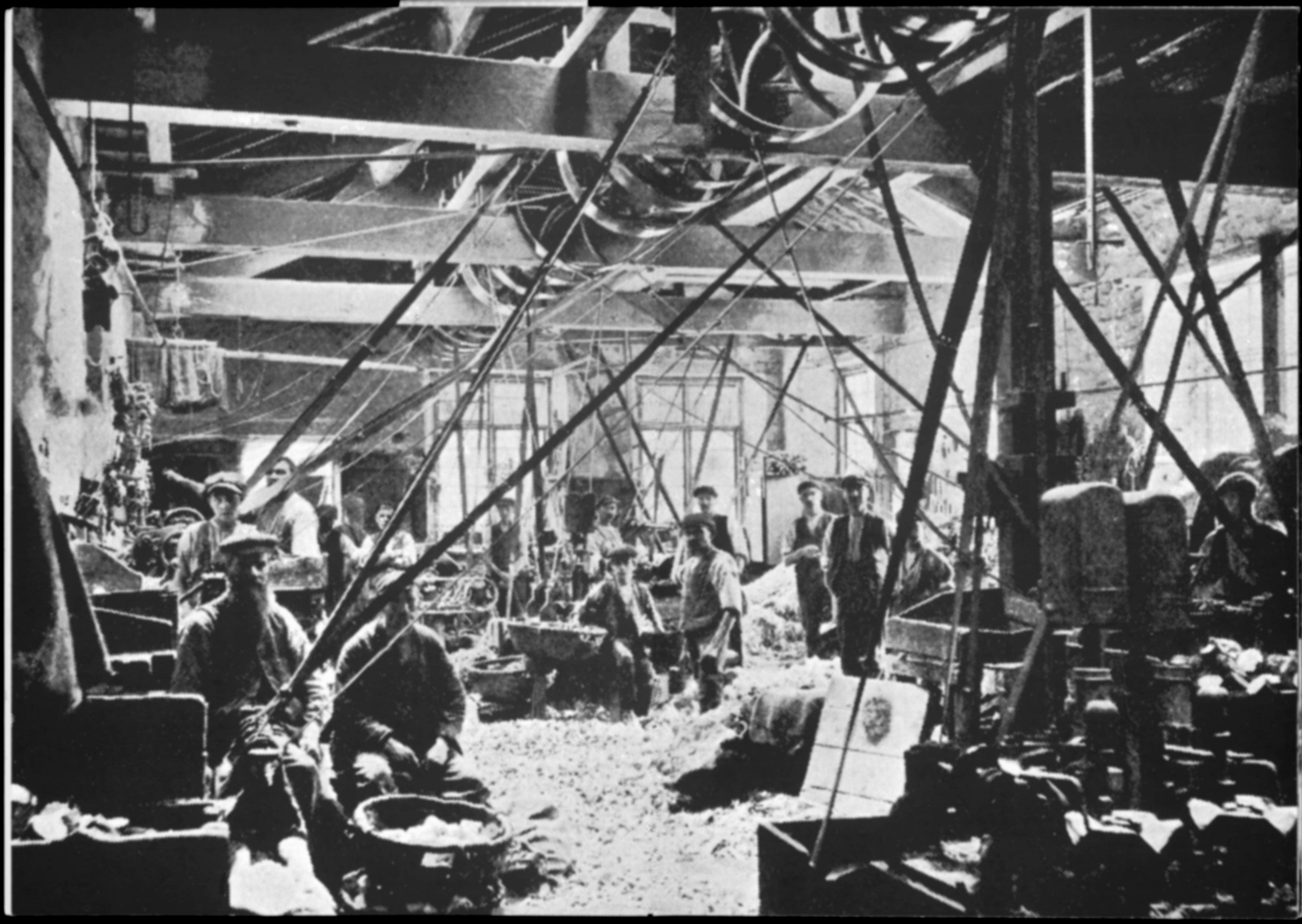
250 men and boys worked here in tough conditions to produce a quarter of a million bobbins a week. Image credits © Historic England.
Take a tour of the mill and the working machinery while the family-friendly trail entertains younger visitors. Image credits © English Heritage.
Between Newby Bridge and Lakeside, the West Windermere Way follows the Lakeside and Haverthwaite Railway. This steam train service can give you extra travel options when using the West Windermere Way. At the Lakeside ferry terminal, onward connections are available from Windermere Lake Cruises, and Newby Bridge Halt station is a 5-minute walk from the Swan Hotel. See Lakeside & Haverthwaite Railway for timetables and more details.
Passengers ride 1950s carriages through the beautiful Leven Valley countryside and along part of the western shore of Windermere. Image credits Sara Spicer and © Lakeside and Haverthwaite Railway Company Limited.
If you are on the West Windermere Way at dusk, look out for small dark shapes darting among the trees. These are likely pipistrelle bats, feeding off midges and other small insects that gather around the trees. All 8 of the bat species in Cumbria live in the landscape around Windermere. The Lake District is an excellent place for bats. Water and trees mean plentiful insects everywhere, and so plenty of food. Just one pipistrelle bat can eat 3,000 bugs in a single night. As part of building the West Windermere Way, we installed 40 bat boxes on trees alongside the trail to support bat conservation.
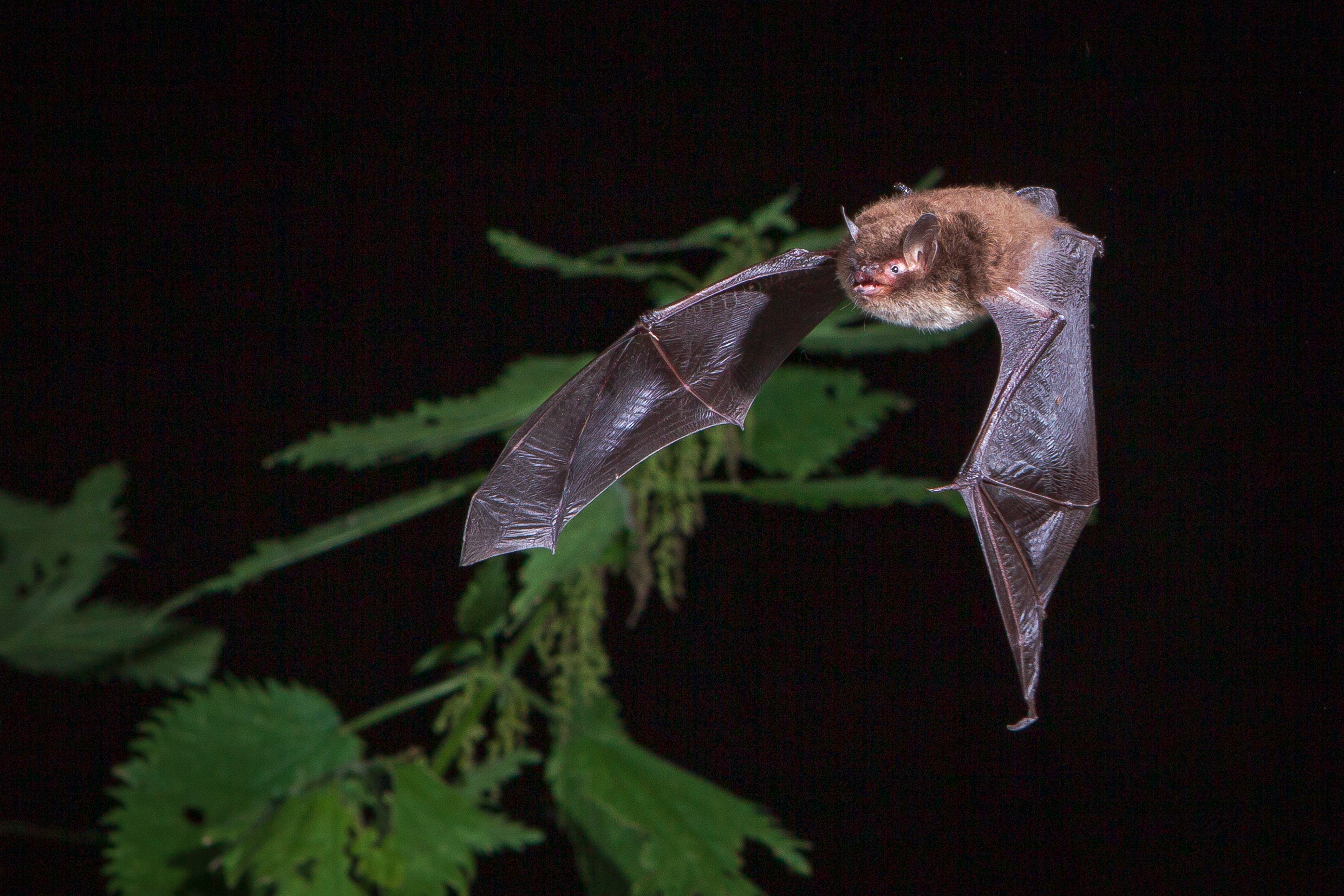
You might be lucky to see a Daubenton’s bat, a specialist water predator. They eat aquatic invertebrates or insects caught on the water’s surface. They skim along the water like tiny hovercraft, picking off prey as they go. Image credit: Brett Lewis.
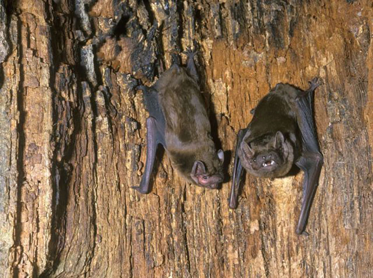
We found a colony of noctule bats during surveys for the West Windermere Way. The largest bats in the country, noctules almost always roost in trees. They feed off large moths and beetles high up in the sky. You may seem them swooping above the lake like a swift, early in the evening. We avoided the roost so as not to disturb them, and we have also protected it since then. Image credit: (c) Hugh Clark @ www.bats.org.uk.
This project is partly funded by:
Also see our West Windermere Way Project page for further information.


