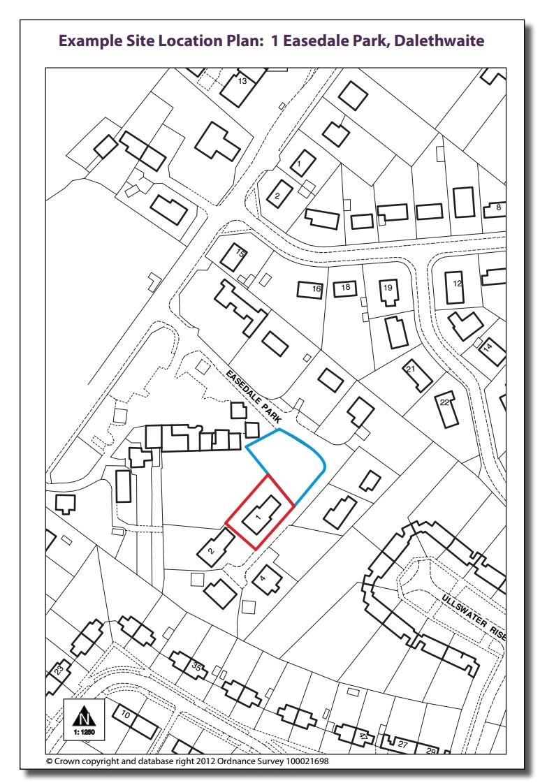
Most planning applications need to include a site location plan, also known as a location plan. This shows the proposal in its surroundings. The site location plan allows us to identify the extent of the land to which the planning application relates.
In most cases it is a minimum legal requirement that a planning application is accompanied by a site location plan. If your application needs a location plan but does not include one, we will not be able to consider it.
Your site location plan must:
Because of copyright restrictions we are unable to provide you with a site location plan. There are a number of organisations and companies from which you can purchase a site location plan. We also often receive copies of land registry plans which applicants have in their property deeds.
No. We will only accept site location plans in metric scale.
No. Ordinary recreational Ordnance Survey maps are not accurate enough. Photocopying an Ordnance Survey map is also a breach of copyright.
Yes. The map below is an example of the type of map we expect. This map is to a metric scale, shows north, clearly identifies the site relative to other buildings, and shows other land in the applicant’s ownership.
