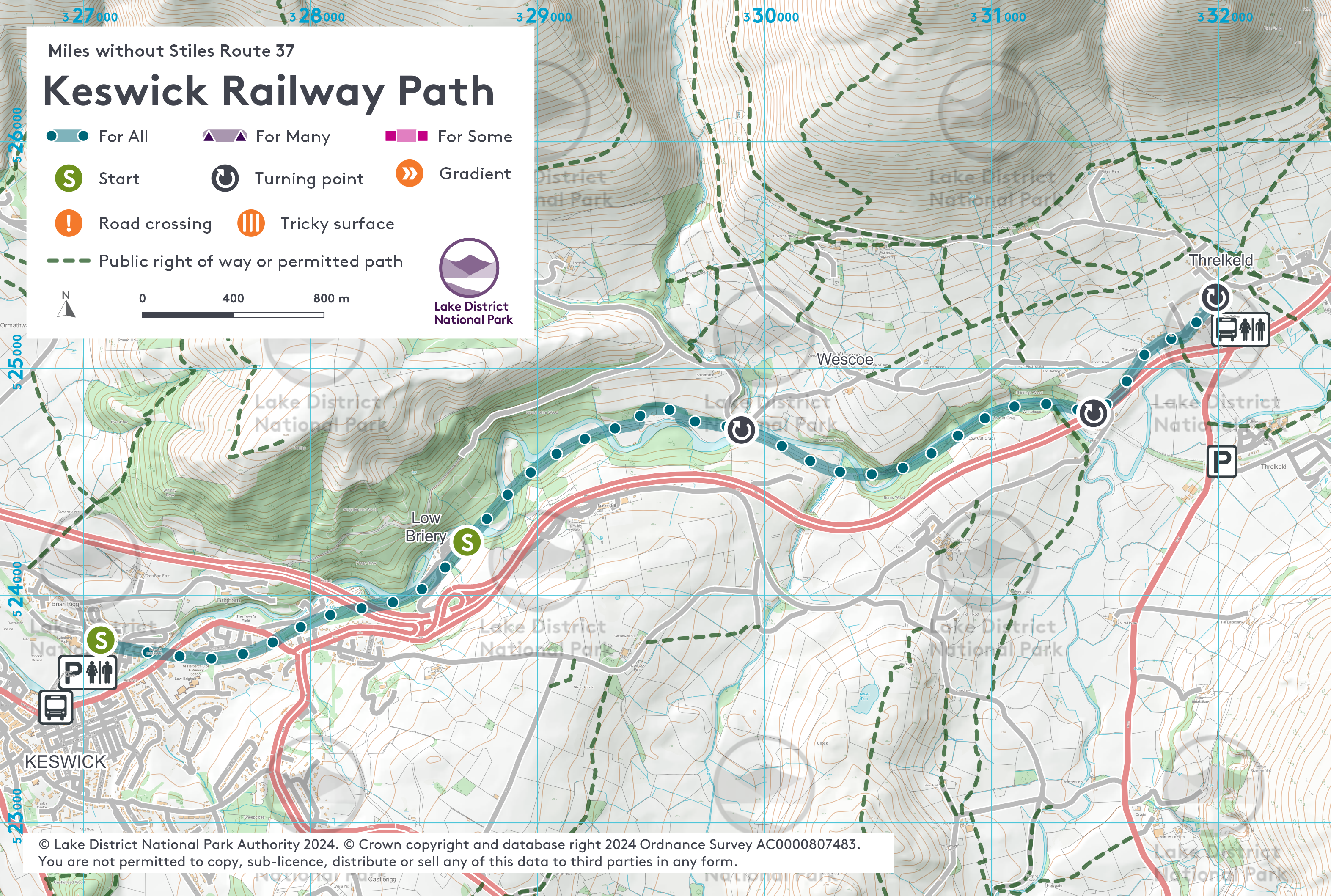
A stunning walk through the River Greta gorge - OS Explorer Map OL4.
Since the reopening in December 2020 the trail is now accessible for all – all gradients and surface have been designed for all levels of mobility.
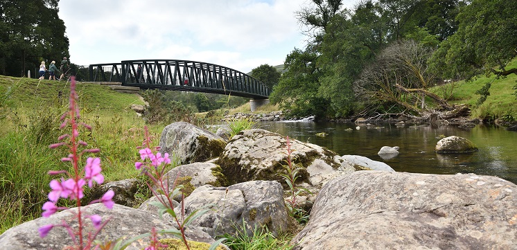
The trail (5km each way) follows the route of the old Keswick to Penrith Railway, and weaves its way over the River Greta on some of the original Victorian railway bridges and some rebuilt following Storm Desmond. This fast-flowing river is home to herons and dippers.
From the car park, the former railway station is on the right. The last train left Keswick station on 4 March 1972. After 1 km pass under the A66 road bridge through the Bobbin Mill tunnel, re-opened in 2020 after being buried following the construction of the Greta Bridge in the mid-1970s. The path leads to a shelter and seats, with information panels.
Beyond this, a railway bridge takes you on the final push to Threlkeld. Access on to the pavement via the zigzags next to the A66 and continue to the village for 0.75 km for refreshments in two pubs and a coffee shop and toilets in the village hall. Alternatively, turn right before the last bridge to follow permitted paths to Threlkeld Quarry for farm shop and museum (1.2km, not suitable for all wheelchair users).
There are no toilets along this route. The nearest public toilets are next to Bell Close car park in Keswick, approximately 10 minute’s walk from the trail start. There are further public toilets in Keswick town and at cafes in the local parks if you are using their services. In Threlkeld the toilets in Threlkeld Village Hall and Coffee Shop are open to the public, in the middle of the village 300m from the trail end.
Visit Keswick to Threlkeld Trail project history to find out how this route was upgraded following devastating storms.
Please note that mobility scooters must be class 2 or 3 on the route.
Public car park opposite old station building.
Postcode: CA12 4NP
Grid reference: NY 270238
W3W: ///longingly.scouting.resides
Grid reference: NY 314248
W3W: ///behalf.enforced.cook
Car parking and refreshments are all available at the start. Coffee Shop and pubs in Threlkeld.
Bus: services to Keswick from many destinations, visit traveline for details of timetables. The nearest bus stop is at County Corner on Penrith Road. Buses run regularly between Keswick and Threlkeld, service X4/5 Stagecoach, meaning you can make this a one-way linear walk. Car: follow the signs for the Leisure Pool where public parking is available, including disabled bays.